

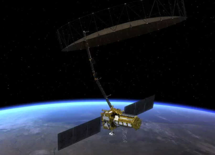
The collaborative venture between NASA and the Indian Space Research Organisation (ISRO) has resulted in the creation of the ‘NASA-ISRO Synthetic Aperture Radar’ (NISAR), an Earth observation satellite scheduled for launch in early 2024. NISAR is designed to offer extensive insights into Earth’s forests and wetlands, crucial ecosystems that influence the global carbon cycle and, in turn, impact climate change.
NASA’s Jet Propulsion Laboratory (JPL) highlighted that the radar technology onboard NISAR will conduct frequent scans of Earth’s land and ice surfaces, aiding researchers in understanding how these ecosystems absorb and release carbon. Forests retain carbon in their wood, while wetlands store it in their organic soil layers. Any disruptions to these systems may lead to the release of carbon dioxide and methane into the atmosphere, potentially affecting the balance of the global carbon cycle.
By monitoring global-scale changes in land cover, scientists can analyze their influence on the movement of carbon among the atmosphere, land, ocean, and living organisms. NISAR’s advanced radar will provide comprehensive insights, allowing researchers to study Earth’s land and ice condition comprehensively, both spatially and temporally.
This mission represents an equal partnership between NASA and ISRO, marking the first joint development of hardware for an Earth-observing mission between the two agencies. While JPL leads the U.S. component of the project, contributing the L-band SAR, ISRO’s U R Rao Satellite Centre in Bengaluru manages the ISRO segment, responsible for the spacecraft bus, S-band SAR electronics, launch vehicle, and mission operations. Additionally, NASA oversees several components of the mission, including the radar reflector antenna, data communication subsystem, GPS receivers, and payload data subsystem.